Home -> Articles -> John Muir Trail
The John Muir Trail
written by Greg Cope
John Muir Trail Map | Gear List | John Muir Trail (Pictures Only)
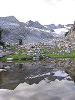
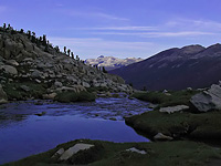
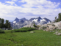
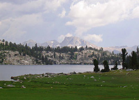
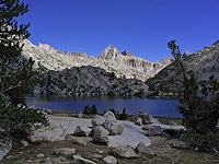
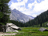
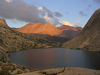
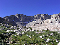
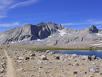
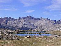
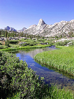
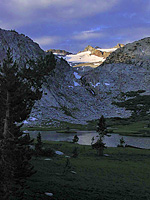 The John Muir Trail (JMT) stretches 212 miles between Yosemite National Park in the north and Sequoia National Park in the south, terminating/beginning on the summit of Mount Whitney. Passing through what is arguably some of the finest alpine territory in the world, the trail works its way through 3 National Parks (Yosemite, Kings Canyon and Sequoia), two designated wilderness areas (John Muir Ansel Adams Wilderness), and a national monument (Devil's Postpile). Passing alongside 14,000 foot peaks and countless lakes and streams, the trail offers endless views, fishing, mountain climbing, and something for the adventurer in us all.
The logistics of such a long backpacking trip can be daunting. Often hiked from north to south - allowing hikers to acclimate easier than the alternative direction - many spend approximately three weeks to hike the trail. Given this duration, the majority of hikers resupply consumables (such as food) at four of the relatively convenient locations along the trail: Tuolumne Meadows post office, Red's Meadow Resort, Vermillion Valley Resort, and the Muir Trail Ranch. What seems like the largest logistic dilemma however, is finding transportation between Happy Isles and Mt. Whitney: given the lack of coherent public transportation between the two ends of the trail forces many to hire costly private shuttles, use a combination of public transportation and hitch-hiking, or have a friend of family member provide a shuttle.
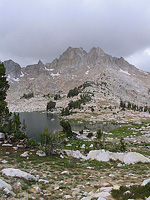
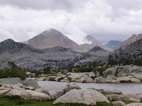
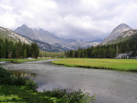
In the summer of 2003 I hiked the length of the John Muir Trail solo. My schedule had constrained me two weeks on the trail, and given my options I decided to try and hike the trail in its entirety. In hindsight however, two weeks was an incredibly fast pace - the John Muir Trail and surrounding areas have so many beautiful areas you could spend weeks exploring, it was tough to be passing through so quickly. I kept a journal of my trip, and below is a day by day account of my thru-hike of the John Muir Trail.
Day 1 : The beginning of my trip started off with a lot more stress than I had anticipated. Although I have backpacked solo on numerous occasions, the thought of two weeks alone in the wilderness was hard to grasp. I am lucky enough to have a very kind father who put up with my stress for a few days and provide a shuttle from Whitney Portal - where I left my car - to the start of the John Muir Trail at Happy Isles in Yosemite Valley. My resupply package had still not arrived at one of my resupply points, Red's Meadow, and this was weighing heavily on my mind as I departed the trailhead at 1PM, passing many people with awkward stares in my direction: I could only imagine what some of these people were thinking. The sign at the bottom of the trail led me to believe the JMT to little yosemite valley was closed due to a rock slide, an old sign according to a Park Ranger I talked to half-way up. The people thinned out as I passed the turnoff to Half Dome and solitude came as I ate my dinner at a nice lookoff toward the Clark Range. Eating my dinner, macaroni and cheese, the stress I had earlier in the day just seemed to melt away. Still energized, I hiked late into the evening, seeing a lot of wildlife along the way, including a small Black Bear and a Mule Deer whose red fur color glowed in the dusk light. A quiet, unpopulated, and remote campsite a few miles short of Sunrise High Sierra Camp was a nice contrast to my earlier day.
 Day 2: The blackness lifted as I opened my eyes. Funny, I thought, the muffled sound I heard was through my left ear - the ear against the ground. As I turned my head to look, I found a deer grazing within inches of my head - the sound I heard the grass it grazed on being pulled from its roots.
An early start led me through the Sunrise High Sierra Camp and up through Long Meadow. I found myself over Cathedral Pass and through Cathedral Lakes Basin, and before I knew it I was in Tuolumne Meadows, wolfing down a cheeseburger.
The next stretch of the trail - Lyell Canyon - is long, flat, and made for easy hiking. The storm clouds moved in, and by 3 PM the rain had started to fall. Taking a break underneath my tarp, lightning sparked all around me overhead, the thunder cracking and echoing through the valley. The storm passed quickly and I found myself on the trail again. An hour later I was hiking up the head of the canyon in the late afternoon sprinkles. Crossing a small stream, I followed what looked like the trail past some occupied camps and small tarn to a nice protected campsite. After realizing the trail went the other direction at the stream crossing, camp was already set up and dinner was on the stove. A beautiful area, but so many people. It was quite a contrast to most of my previous Sierra trips, where I sought out solitude. It was then I realized how constrained I might be as a thru-hiker, to end up camping in crowded spots.
 Day 3: An early start, a fast breakfast, a no so fast break from camp, all under a partly cloudy sky. The immense views and peaks opened up as I quickly approached Donahue Pass. The clouds weren't dissipating and, from my previous experience with monsoonal weather such as this, I anticipated rain in the forecast. Passing the somewhat anti-climactic Donahue Pass the trail led down toward Rush Creek, a beautiful little basin alive with streams and wildflowers.
A quick jaunt led me over Island Pass and down to a favorite lake of mine - 1000 Island Lake, where I stopped for lunch. The weather had been building all morning, and as I sat eating lunch the intermittent sprinkles began. I quickly packed up as the rain started coming down hard, then harder. For a brief second I swoar this storm cell hovered solely over my head, never seeming to pass. There was thunder in the distance, most likely over Bald Mountain and the Glass Mountains to the east, and I was finally forced to proceed hiking to try and keep under the cover of the trees. At last, a serious downpour came as I was on the ridge between 1000 Island Lake and Garnet Lake. Surprisingly, the tall Sequoia trees along the trail were ample coverage to keep me dry - provided I stay underneath them.
 The rain subsided a while later, at least enough for me to continue hiking. Approaching Garnet Lake, I met a couple who were quite talkative and very helpful in giving advice about the best campsites between here and Red's Meadow. At the outlet of Garnet Lake, I met met a fellow who was hiking the Pacific Crest Trail (PCT) in 600 mile sections. We talked for a good deal of time, he telling me about how he contracted E. coli poisoning from drinking the wrong water and not treating it (this after he shook my hand). The rain began once again. Continuing down the trail I was hoping my pack was fairly rain-tight the way it was rigged (top opening was covered by a garbage bag). The rain let up at Shadow Lake, in time for the steep climb up the ridge. It is here where the PCT and JMT have diverged, and part way up the ridge I was wondering why I didn't take the PCT down to Agnew Meadows.
Reaching Rosalie Lake, I took a breather. This was where the couple earlier in the day had suggested I camp. It was about 4 PM and I still had some energy in the reserves. The lake was completely placid save for the few raindrops that broke its reflection, a fog was enveloping the surrounding trees, and I could hear several coyotes echoing each other around the lake. The area seemed just a bit too ominous. I chomped down a snickers and was on my way. By the time I reached the region around Trinity Lakes the mosquitoes were in full force, making me whip out my mosquito head-net in a frenzy. The couple earlier in the day was right: if you don't think you'll make it to Red's Meadow, stop at Rosalie Lake. I think deep down I wanted to go all the way to Red's Meadow. So I cranked it into overdrive until I arrived at the maze of trails surrounding Devil's Postpile and Red's Meadow. After some worrying about my location, I arrived at the familiar Red's Meadow campground and....$16!!! What?!? The sign says $16 for a backpackers spot. And, they were all occupied. I turned on the smiley face and walked up to the first people I saw, inquired about space, and they said..."I guess its paid for. feel free to camp wherever." OK. I picked a nice spot below a tree, set up my tarp, and ran into the nice hot shower. By the time I was cleaned up and back at camp for dinner, it was getting very dark and was 8:30 already. ouch. I made dinner, ate, and was out like a light.
Day 4: I awoke around 6AM as usual, quick to pack up my things and eat a little breakfast at the same time. I was excited to make a phone call at the Red's Meadow Resort. A small stint on the trail led straight to the resort, where there was the store and a restaurant. A phone call later and I was in the store to pick up my resupply package. About to tear open my self-mailed box of supplies, someone approached behind me and asked: "excuse me, are you Greg?". "Um, yes..." "Hi, I'm Rosie." Instantly I remembered who she was. We had met over the internet and she had ended up leaving a permit for me in Tuolumne which I ended up not using. We talked for some time and she had a very intriguing proposal. She was taking a horse from the resort to Duck Creek about 12 miles down the trail and had an opening. Of course I just couldn't refuse this opportunity! I was in low spirits that morning and this turned everything around. A minute later I was frantically shuffling my food around to keep what I wanted and leave the surplus food. In record time I was ready to go and we were off to the stables.
Down the trail on our horses, a mule carrying our packs and I gotta say, if there were any stretch I would want to ride a horse, that was it. Those 12 miles were hot, dusty, and dry! We made it to Duck Creek around 1 PM. A little lunch and I was on my way, Rosie had set off a few minutes before me down the trail. We crossed each others path a few times, once at Purple Lake. I finally stopped around 4 PM at Lake Virginia. The views here were quite nice, and the way the sky looked, I felt this might make a very nice camp spot. By 5 PM the storm approached and it began to rain - hard. Thunder and lightning flashed all around. Surprisingly, it was a fun storm to ride out, counting the seconds between lightening and thunder, and just listening to the orchestra of the storm. The storm slowly pass, and left in its wake a strange and eerie landscape. Fog stretched into the far valley below, and as I was eating dinner later in the evening, it reached down and engulfed the surrounding mountains and lake. I climbed into bed just in time, as another storm cell passed overhead to unleash itself. But sleep finally came.
 Day 5: This planned to be a long day, wanting to make it to Quail Meadows near Vermillion, if not up and over Bear Ridge. Yet, I awoke to more rain at 6 AM. I packed up my things and headed out onto the trail, snapping some pictures of Lake Virginia along the way. Being on the JMT and hiking so many miles in a day can sometimes take a toll - and this was only day 5! I descended down to Tully Hole, losing precious altitude that I knew that same day I would have to gain back, only to lose once again. Down along Fish Creek the mosquitoes began to become pesky, but nothing a little DEET can't handle. I passed Rosie as the trail ascended up toward Silver Pass, and we said our goodbyes. I tried to let her know how appreciative I was of the horse ride, but I never felt like it was enough. The trail skirted the outlet of Squaw Lake (a lake I revisited a few years later on a trip to along the Silver Divide) and made a final ascent past some lakes up to the pass. Although I recall reading somewhere of the spectacular views from this pass, the clouds and fog enveloped any view. At the top, I met some other folks, including another lightweight backpacker Andrew who was doing the JMT in 12 days. I descended down from the pass to find Andrew a few miles ahead stopped and staring into the bushes alongside the trail. I finally spotted what he was looking at. There was a pheasant cooing. After Andrew had left, I noticed that seemingly out of nowhere, several chicks emerged! They were so camouflaged it was amazing.
 Descending further down toward Mono Creek, the trail got very rough, enough so that my knee had begun to hurt....bad. Nooooo! Not the knee! Finally, making it down toward Quail Meadow I had a late lunch which ended with the sky opening up - an utter downpour. I immediately realized this was going to last for a while, and tried to spot a place for my tarp. Unfortunately, my first choice was quite pathetic and water started to pool almost immediately. I looked for over 30 minutes wandering up the trail and down trying to find a place to camp that wasn't a puddle, only to find the best place was where a couple had camped already.
Having little choice I got their attention and asked if I could camp near them. A quick affirmative and my tarp was up. This site was much better, but it may have been a little too late. Save for my sleeping bag that I had double bagged in garbage bags, everything seemed soaked through. I stripped down and slid into my sleeping bag to warm up a bit, and I sat there hoping the sun would come out. Many thoughts of nearby Vermillion Resort passed through my mind (I had heard they are very courteous to thru-hikers; even providing a free night stay and a free beer).
Three hours later, the rain let-up and the sun came out. I had a chance to try and dry everything out! Yes! I was so much happier. A little dinner, and I was in bed trying to tune in a bit of entertainment on my small radio. Lying there on my stomach with the crashing sound of the nearby river, it was a great night in the woods. Then the sound of the river suddenly seemed to get muffled. I looked up and noticed my entire field of view was blocked. A bear...a BIG bear. I coughed and it looked at me with its light brown nose (which was about 3 feet from my face). "Get Outta here!" I said, and it slowly walked away looking at me.
Day 6: I woke up to another gray sky again. Will this weather ever let up? Today began with what I had anticipated to be a miserable hike up Bear Ridge. I had spotted this on the map while planning the hike and it looked like the worst section of trail - climbing several thousand feet in a mile or two. Despite how it looked on the map however, it was actually quite pleasant. My knee felt OK going up, but on the latter side I began to get a little limp. Finally reaching Bear Creak the mosquitoes made their presence known again. Hiking up the valley I met a few parties, one of which said their cookpot left out in the rain the day before accumulated about 4 inches of rain in a few hours. Yikes.
 Stopping for lunch the rain began again, forcing me to put up my tarp in order to eat in a dry place. As I continued hiking after lunch I expected more rain, so I draped my tarp over my backpack and head like a poncho to try and stay dryer. Reaching Marie Lake by mid-afternoon, I met a pack train that was going to Whitney from Mammoth with clients who day-hike from camp to camp as the pack train carts everything (more on them later...). I stopped for some time at Marie Lake to not only let the pack train gain a little distance, but to also take in the amazing views of this area.
I reached Seldon Pass a little while later, and descended down the basin on the south side of the pass. This basin, although narrow and small, was quite picturesque. I finally skirted the shores of Salley Keys Lakes. My knee was feeling the effect of today's hiking, and after taking off my shoes to reveal some waterlogged feet, I felt I would make camp here and build a small fire to try and dry out everything that has gotten wet. Of course, it is hard to build a fire with waterlogged wood, and as I got one going with some spare Esbit tabs I carry along for just these times, it started to rain. I sat by the lake for quite some time watching the raindrops in the water and the fish swim and jump. A large Bolete mushroom near the edge of the lake was tempting to try in my dinner, but again I just didn't have the courage (or probably the patience) to cook it. Andrew wandered by (a lightweight hiker I met on Silver Pass) and gave me a very welcome weather report: one more day of 'rain' and then sun. I recall waking up that night to surreal flashes of light in the sky from distant lightning.
Day 7: Excited to get down to Muir Trail Ranch and open up my resupply package, I hurried down from my camp, passing the many camps and several deer along the way. My knee was really not happy with the switchbacks and, while it took longer than expected to make the climb down the trail, I finally made my destination at 9:30 (after a quick glance at Blaney Meadow Hot Springs). Opening up my resupply container, the first thing I dug into were vaccuum packed donuts placed on top. After some mental negotiation, I left behind a lot of what I packed. In the end, the table I sorted my food on looked like a tornado had hit it, but soon was packed up and on the trail in no time.
After days on the trail, I became so experienced with my pace that I could predict when I would arrive at a certain destination. Noon at Piute Creek. 2PM at Fredrickson Meadow. All right on cue. And between it all: rain. After a short climb below Evolution Meadow I became a little worried about the ford of Evolution Creek. I had crossed this 'creek' late last year in september on a trip through Evolution Basin, and even then it was kind of a pain. Now, it is late july and it has probably rained a few inches today. A view of the falls below the ford met my suspicions. Finally reaching the ford in a downpour, I placed my camera and fanny pack into the very top of my pack, and waited for the rain to subside before I charged into the water. The water was cold, but slow moving with not much force to knock me off balance. In I went, water past the knee, then up to the waist, then back to the knee - a bit of scary crossing, but I made it across with relative ease. I kept thinking how difficult or even impossible this is in early season.
In contrast to what I encountered along this trail the previous year, much of the trail was seeminlgy a deep stream. I reached a deserted McClure Meadow Ranger Station around mid to late afternoon. A snickers later I was charging up the trail, with Evolution Lake as my ultimate destination. Ascending the final climb below the lake, I met the ranger from McClure Meadow who gave me the weather report: sun for tomorrow. It was hard to believe him, but was a very welcome thought. I reached Evolution Lake by 6 PM and set up camp in a nice grove of whitebarks along the north side of the lake. I had a neighbor that night, who didn't emerge from his tent until the following morning.
Day 8: Layover day, and the sun was out! I took this free time to lounge, let my knee rest, do laundry, bathe...relax. Of course, I really shouldn't have a lot to say about this day. Much of it passed quietly. Unfortunately, that situation changed as the horse packer group I passed earlier near Seldon Pass showed up late in the day and decided to make the meadow near the lake their home, with camp flanking a small inlet stream. Concerned about their inability to follow simple backcountry camping rules, I asked if they could please find another place to camp. OK they replied, and then proceeded to give up after 10 minutes because they couldn't find a place to put 7 tents together (the keyword here being 'together' - trust me, there are dozens of campsites at this lake). "Do you have to have them together?" I asked. "well we gotta have a common kitchen" the response came. Then the horses came and proceeded to further trample and crap all over the meadow. I was sooo pissed, I said my piece in not so friendly words, packed up my stuff and moved on. Am still wondering whether I was out of line in the way I reacted, but these people were going to camp on the shore of the lake, straddling the trail and an inlet stream. Potentially destroying the meadow and anyone else's solitude at the lake. Luckily, I heard the horses were not going to stay the night at the lake - which would have been downright illegal. So, in light of these change in plans, I proceeded to cancel my layover and pack up my things. Off to Sapphire Lake (where I had camped the previous year while hiking the Evolution Basin Loop). Unfortunately, I didn't sleep well that night due to the fire brewing in my head. I still don't know if they had camped in that area, as I left before the tents were set up, but I doubt they looked for another site.
 Day 9: I have always wanted to stroll through Evolution Basin in the early morning, walking with the light of the alpenglow. That morning I awoke both eager to get on the trail and eager to enjoy this beautiful basin at sunrise. I somehow managed to break camp before 5:30AM. Knowing I wouldn't make it to Muir Pass in time to see the sun rise, I took my time catching some amazing views before reaching Wanda Lake. I reached Muir Pass around 8 AM after skirting several icy patches on the trail and enjoyed some spectacular views in the early morning light. There was someone camped up at the pass near the hut, and we chatted the usual backpacker chat. On my way down I was reminded of how rocky this stretch of trail is. I stopped for a break in a nice tiny meadow, then continued on to reach the LeConte Ranger Station around my expected time of noon. Unfortunately, there wasn't a ranger in site, so I unloaded my lunch bag and ate lunch behind the small cabin. The area behind this particular ranger station seemed to be littered with old arrowheads. Either the ranger has a hobby of making obsidian arrowheads, or this was prime indian territory.
As I was leaving to head downstream the ranger popped into view. I proceeded to spill my guts regarding my incident yesterday. He was quite concerned and said he would not only have a word with the people and their packers, but also check out the meadow when he meets with the McClure Meadow ranger later in the week. I gotta say, having that off my shoulders felt REAL nice.
I made my way downstream and got my first view of the VERY impressive Citadel towering over the valley. Further down, the trail skirted Grouse Meadows where I reached the next trail intersection around 2PM. Curving my way east up the very overgrown trail I was on my way to Mather Pass. The overgrowth disappeared as I entered the region that burnt from the large fire last year; the remnants were quite impressive considering the expanse which burnt. Even more so, it was quite strange to look into a grove of burnt trees and see a tall green tree which escaped the wrath of the fire.
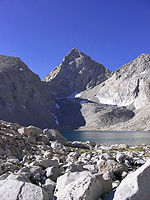
 Further up valley I passed through Deer Meadow, and by this time made my goal for the night to be Palisade Lakes. The trail climbed steeply out of Deer Meadow, ascending what is know as the "Golden Staircase" and indeed, it is a staircase...yet a more proper name like "hell for sure staircase" or "deadman staircase" might apply (in fact, as I was making camp a fellow appeared over the horizon and screamed "woo-hoo" as he collapsed next to the trail; After not moving for about 10 minutes aside from snapping a few pictures he finally got up to find a campsite). Near the top there opened up awesome views of the west side of the palisades. The trail leveled off below Lower Palisade Lake and, not having much of a choice in campsites, I finally found a small site for one person underneath a mangled and stunted whitebark. The beauty of this basin was hard to believe, and after making dinner and cleaning up a bit, I watched the awesome sunset over the lake and up on the palisades. The chill began to set in so after a long day I climbed into my sleeping bag and slowly dozed off at an early hour.
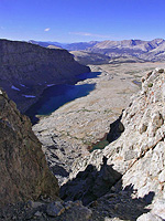
 Day 10: Breaking camp at around 6AM I began the climb up toward Mather Pass. This stretched seemed a bit deceiving as I approached one false summit after another, and given that my map had just too little detail (the contours were 200ft - glad I didn't plan going off-trail), I wasn't really even sure where the trail went. The views were superb, and this upper part of the basin was just amazing. I finally reached the top the the pass around 10 AM and had a marvelous view both south and north. After a much needed rest and snack I began the trip down the switchbacks on the south side of the pass into Upper Basin. This area was on the top of my list of places to visit, and I wasn't disappointed. My only wish was that I could have spent more time in this area...one of the drawbacks of having a job to get back to while trying to hike the length of the John Muir Trail. Split mountain to the east towered over Upper Basin, a basin littered with small lakes and tarns. In addition, several small frogs populated just about every small creek crossing in the upper part of the basin. I decided that the Taboose Pass trail - which stretches from Owens Valley into Upper Basin - is top on my list of passes to take, and this area is top on my list of places to spend some time...
 Making my way down and then back up toward Pinchot Pass, I met and talked to a few people, one of whom was a baseball fan, who kept me current on the scores and standings. Making my way up to Pinchot Pass I passed numerous scenic lakes and finally crested the top of Pinchot Pass, another pass with simply amazing views north and south. Spending a fair amount of time on top, resting and snacking, I finally decided to begin making my way down - hoping to make it to Woods Creek junction for the evening. Hiking down from the pass I got incredible views of Mt. Clarence King. It seemed like a long hike, but I finally arrived at the Woods Creek suspension bridge, an exciting bridge to cross. The camp here was crowded, but I found a nice campspot that provided a little seclusion.
Day 11: I awoke inside a very damp sleeping bag. Inspecting everything around me I noticed that the morning dew had crept into just about everything imaginable. It was as though it rained during the night. After a leisurely break from camp, I began the slow stroll up toward Rae Lakes. The hike along this trail was very pleasant, but further on the basin began to swarm with people, and I felt as though I were at a roadside lake. Before the trail climbs up from the lakes, I took a moment to grab a snack and lay all my gear out in the sun to dry out from the dew that morning. Taking my time, I made it to Glen Pass a little after noon, and was down near Charlotte Lake for a late lunch around 2 PM.
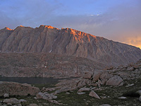
 Toward Vidette Meadow, I stopped to talk and thank a bunch of trail crew workers renovating sections of the trail. East Vidette towered over Vidette Meadow, and the hike up the valley toward Forester Pass was amazingly pleasant and gradual. Passing the turnoff toward Upper Basin, I decided to try and find a camp, finally stumbling onto a nice camp with beautiful views down canyon. I laid out my gear in the sun to dry again, and did a little cleaning up. After dinner, the sun began to set off the south side of Kearsarge Pinnacles and University Peak, making them glow in the evening light. Running a little low on food, I realized that I had enough food for 1 more dinner, and 2 days. Probably just enough to get me to Mt Whitney.
Day 12: I awoke to a light breeze which really chilled me to the bone. The last few days have seemed colder than normal. Looking up, I saw a spectacular alpenglow off the peaks above.
That morning I resumed my climb up to Forester Pass and, like yesterday, the climb was quite gentle. I reached a lake below the pass that had an amazingly deep blue color. Guessing where the pass actually was much of the hike up, I finally reached the top about an hour later. After spending some time enjoying the amazing views, I made my way down the south side of the pass. Anyone who has been on this stretch of trail has to appreciate the amount of work (and dynamite) that went into this portion of the trail: it is etched out of a granite cliff for the first 500-1000 vertical feet. It was dizzying hiking down, especially with a wind that was incessantly slapping me in the face. I had hoped to stop at Bighorn Plateau - a favorite of mine - for lunch yet the wind just didn't make that seem feasible, and I ate lunch a little further down between the plateau and Wallace Creek. Crossing familiar ground that I had hiked last year on a backpacking trip through Sequoia National Park, I finally made my way toward Crabtree Meadows, and then east toward Mt. Whitney.
 I was a little hesitant to try and camp at exposed Guitar Lake, as the winds just didn't seem to die down. In addition, for my last night out I would have liked a little solitude...not what Guitar Lake is known for. About 1/2 a mile below the lake, a few climbers had told me about a nice campsite a few hundred yards above the lake that would provide ample solitude. I decided to investigate - and was quite relieved to find the site they talked about as there were at least 15 tents down near the lake. No one was around this secluded camp with amazing views, where I washed up while the sun was still out.
It seemed hard to stay warm. The wind earlier in the day had died down, but my fingers and nose still felt quite numb. I was hoping for a warm night as the sun crept down past the horizon, providing some great views. Several fighter jets passed overhead again and again, in addition to some clouds which I hoped were dying down rather than building. I had a rough nights sleep that night.
 Day 13: I got an early start in the morning, breaking camp a little after 6 AM. I recalled from an earlier trip up Mt Whitney the hike up to the summit was simply hard and full of switch backs. I remembered correctly. Passing quite a few people I reached trail crest around 7:30. Dropping my pack I was on my way to the summit. It was windy along this portion of the trail, and when I passed the 'windows' I was struck by an intense gust which almost knocked me off my feet. My fingers, nose, ears, and practically the rest of my body were frozen. There were already some day hikers this high, making me wonder what time they started that morning. I reached the summit around 8:30. There were already several people there. I spent some time up top, snapping some photos and signing the register. This was my final day. August 8th, 2003. Hamburger day. After an hour or two I departed and made the long trip down to Whitney Portal. Along the way, I kept thinking "why the hell would anyone actually want to backpack along this stretch of trail". It was kind of awful. All the trail does is switchback - steeply at times. And there were so many people, a reminder that I was nearing civilization. But looking around at the scenery, it is easy to see why it attracts so many people. I completed the hike, reaching Whitney Portal around 2:30, where I rushed to the Portal Store and ordered a hamburger with fries. Although it took quite some time to receive, it was definitely worth the wait.
Greg Cope
More information on the John Muir Trail:
- The Pacific Crest Trail Association - Fantastic description, links, FAQ's, etc...of the John Muir Trail from the PCTA.
- JohnMuirTrail.org - Descriptions, information on preperation, etc...